
Google Maps’ Android and iOS apps now include a feature that displays the air quality index of various areas on the map. However, this feature is only available in the United States.
See Air Quality on Google Maps
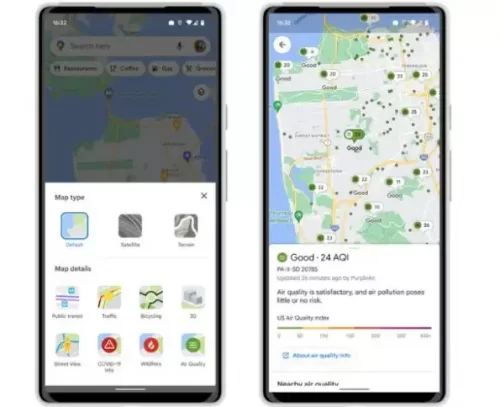
If you search for a location for directions or other information, you can turn on the layer to see the air quality of that location and even nearby locations.
Simply tap the circular button on the right side of the search bar to open the various map layers. One of them is the quality of the air. When enabled, you will notice colored dots in various places. Red represents extremely unhealthy air quality, yellow and orange represent unhealthy air quality, and green represents healthy air quality. Take a look at how it appears.
In addition, Google Maps now includes a wildfire layer, which displays information about active fires in the surrounding area. The data comes from the National Interagency Fire Center (NIFC). This is also now operational. In addition, smoke data will be added to Google Maps in the United States.
The ability to view air quality on Google Maps has now been made available to all users.
Read news: Android 13 Beta 3 Platform Stability is released by Google